Research Centerfor Earth Operative Monitoring
| Research Centerfor Earth Operative Monitoring |
|
 |
|
Monitoring the volcanic eruption in Iceland (update). / May 12, 2010 /
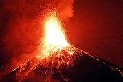
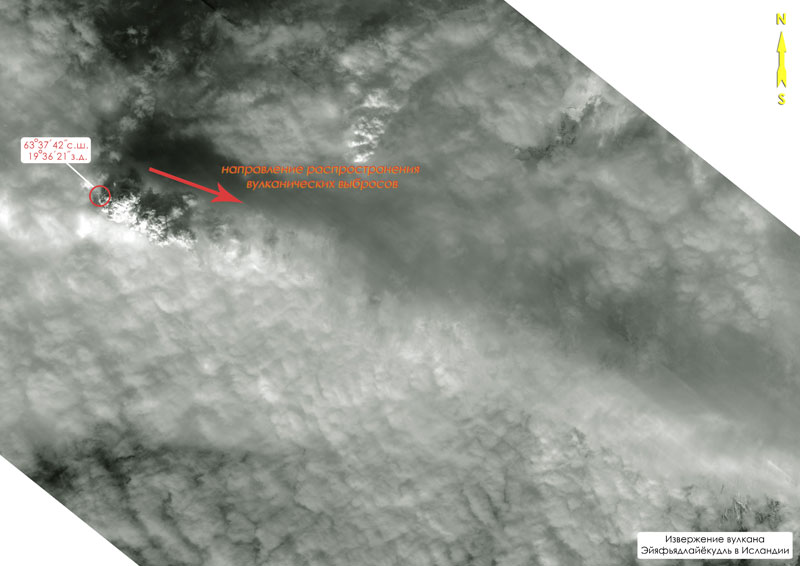
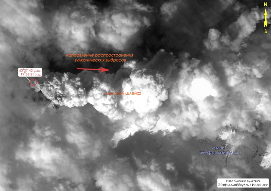
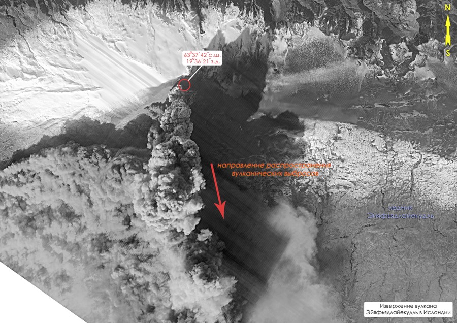
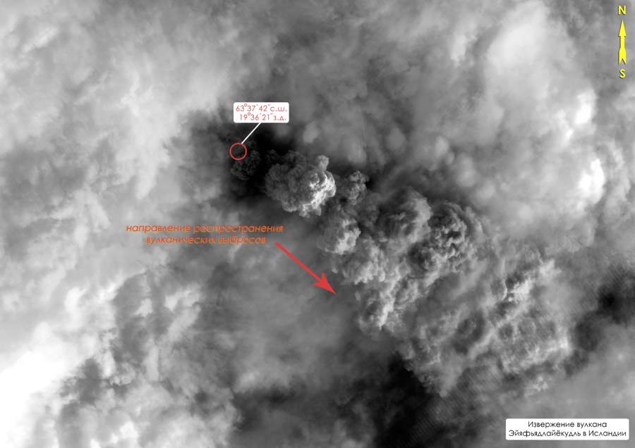
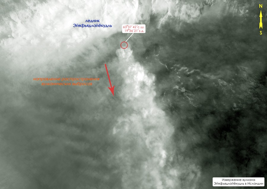
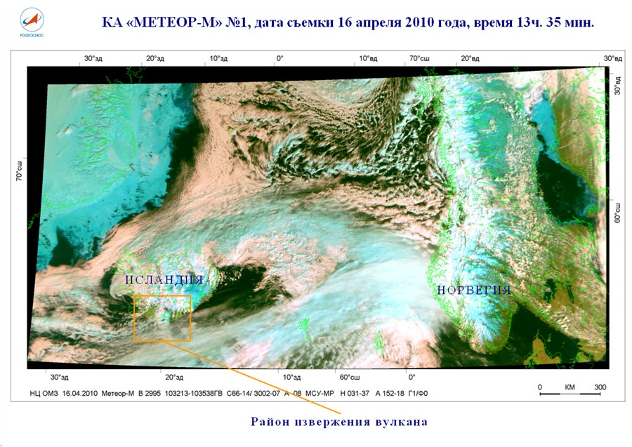
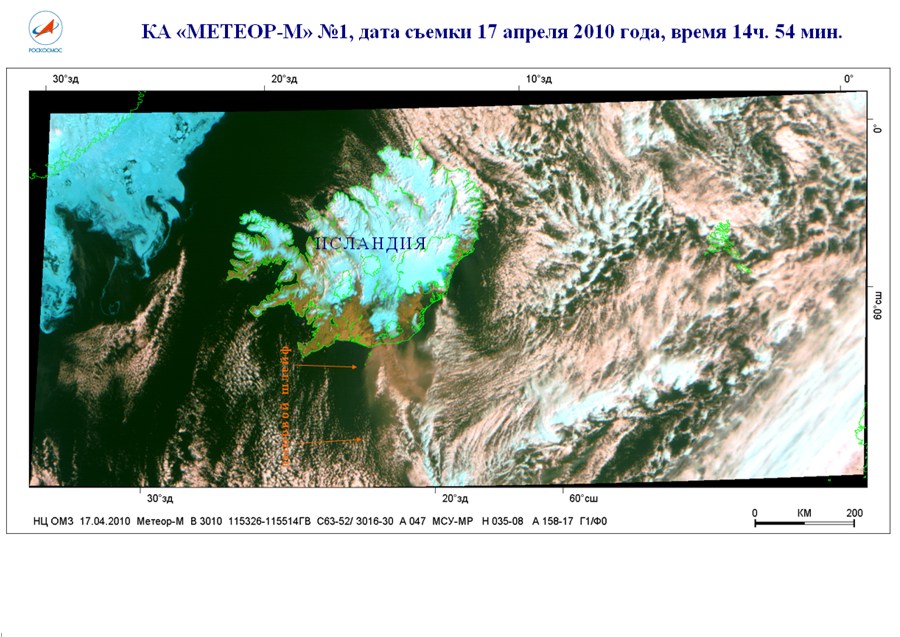
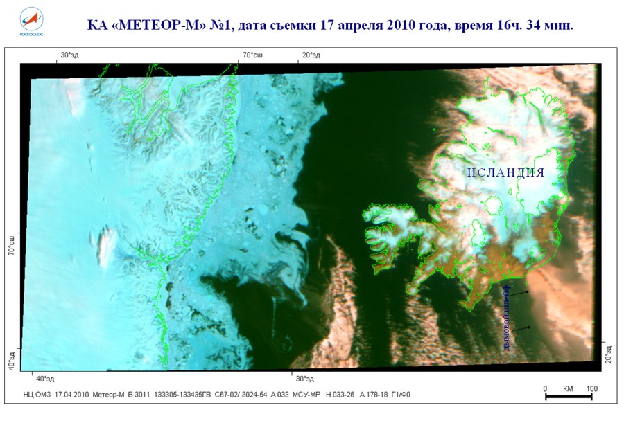
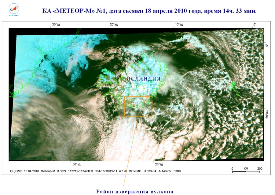
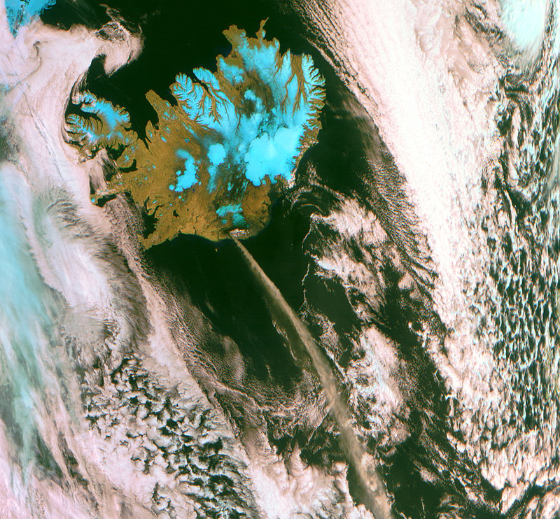
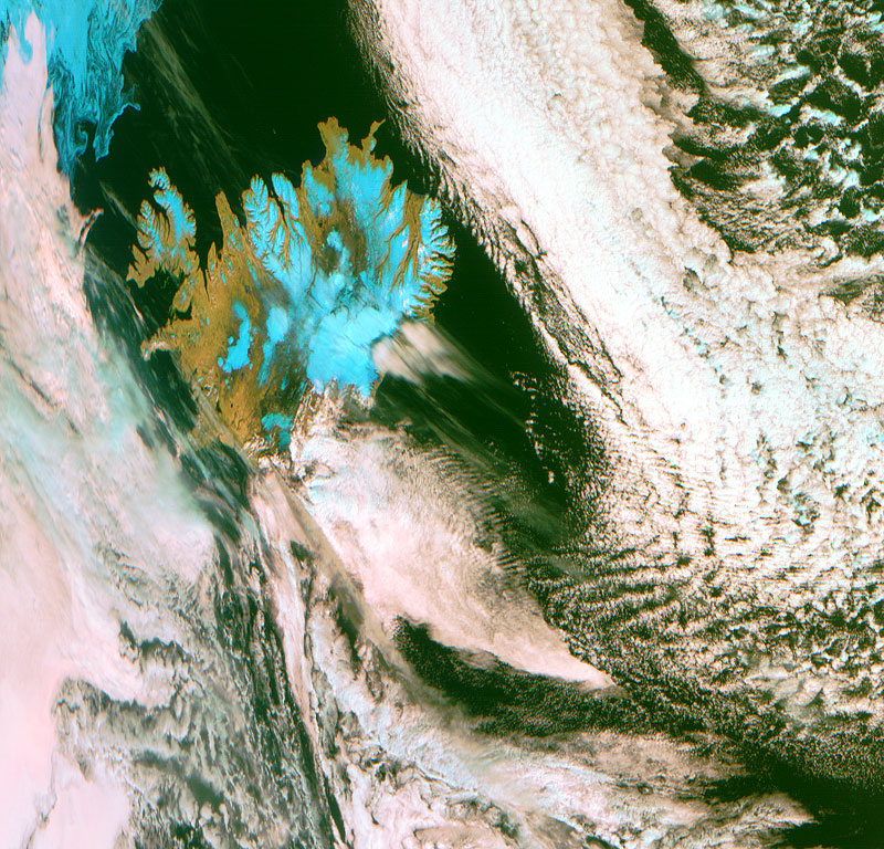
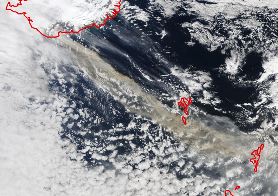
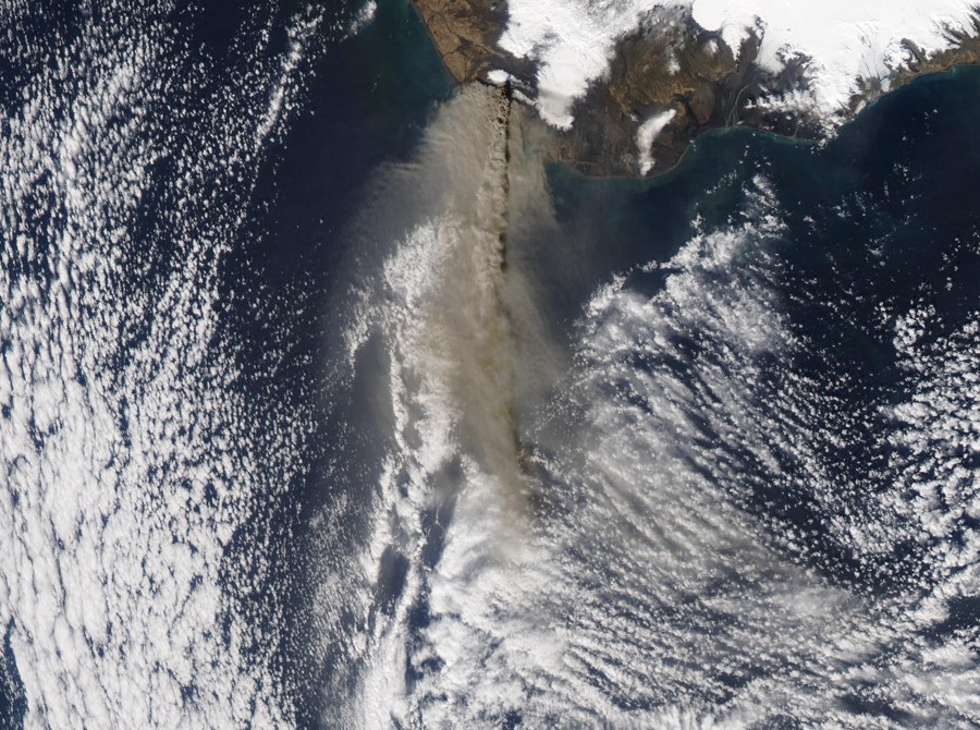
Eruption Eyyafyatlayokudl the south of Iceland began on the night of April 14, 2010, approximately 22 hours. Of the disaster zone were evacuated about 800 people. April 15 due to emission of volcanic ash several countries in northern Europe were forced to close their airports. Eyyafyatlayokudl (Eyjafjallajokull) means "Island of mountain glaciers. The volcano is located 200 kilometers east of Reykjavik between glaciers and Eyyafyatlayokudl Mirdalsyokudl. This — the largest ice caps in the south of the northern island nation, covering the active volcanoes. Vulcan Eyyafyatlayokudl a glacier conical shape, the sixth largest in Iceland. The volcano is 1,666 meters. Diameter of the crater is 3.4 kilometers, the glacial coverage — about 100 square kilometers. Images by «Resurs-DK» №1
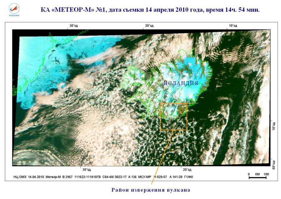
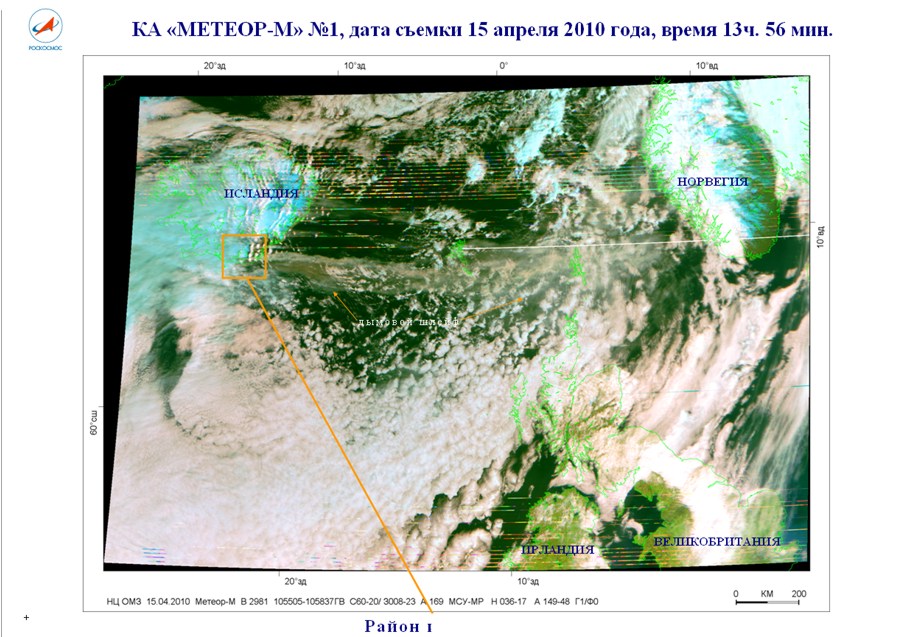
Images by «Meteor-М» №1
Images by Terra/MODIS
Images by Aqua/MODIS
|
|||||||||||||||||||||||||||||||||||||||||||||||||
© Official Site of Research Center for Earth Operative Monitoring (NTS OMZ). Where any materials on this site are republished or copied, the source of the material must be identified. | |||
|
127490, Moscow, Decabristov st., b.51, h.25
|
|
||