
Research Centerfor Earth Operative Monitoring
| Research Centerfor Earth Operative Monitoring |
|
 |
|
main page
Space monitoring of crisis areas of the mining industry.. / January 19, 2009 /
At all times in a mining industry often enough there were the extreme and critical situations which were carrying away lives of huge number of miners, working in mines, and bringing destructions of capacities and an infrastructure. Modern manufactures are equipped by the automatic and automated systems of tracking a condition of dangerous objects, including being underground. Regular external monitoring of dangerous objects with use of data ДЗЗ allows to reveal operatively developing critical processes of natural and technogenic character, to predict development of a situation and to develop ways of prevention of emergency situations. One of examples of possibility of use of the data of the detailed permission «Resource-dk» for the decision of similar problems is spent NTS ОМЗ monitoring of area of a failure of potash mine to Berezniki the Perm edge.
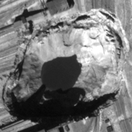
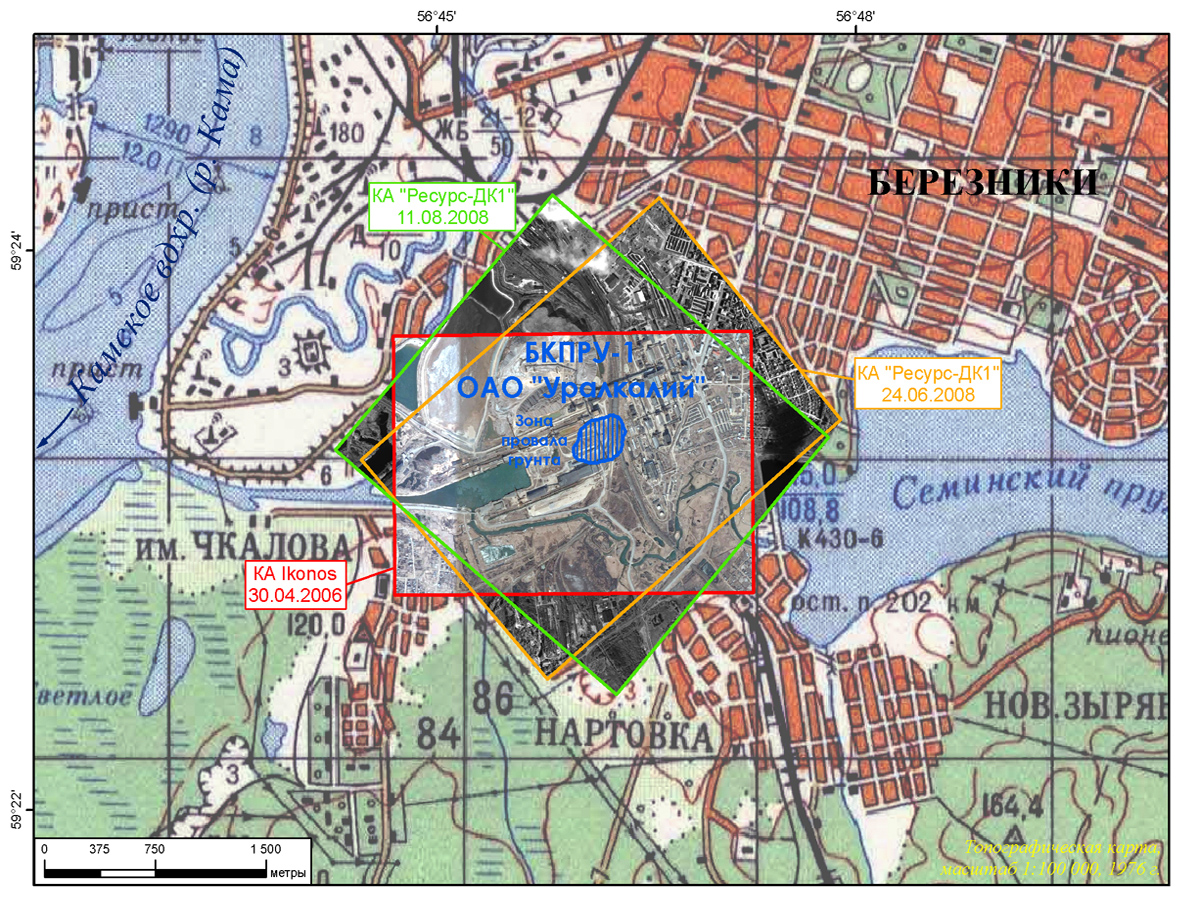
According to electronic mass-media, a picture of events on Bereznikovsky potash industrial рудоуправлении №1 (БКПРУ-1), belongs Open Society «Uralkaliy», looks as follows. On October, 19th, 2006 (under the informal data, for some days earlier) on mine the raised inflow of brines accompanied by increase of level of hydrogen sulphide has begun. It, on one of versions, is normal process, considering features of a geological structure of a site of mine which has been involved in 1928 Mine field БКПРУ-1 is located, basically, under a city territory; The total amount of mine emptiness is estimated in 84 million cubic metre and is approximately comparable to volume of 11 thousand inhabited five-floor houses (for comparison: the inhabited part of Berezniki totals hardly less than 1300 inhabited apartment houses). In the morning on October, 28th, in connection with situation deterioration, the decision on cessation of work of mine and its operated flooding was accepted. The same day on the main site of Jajva – Solikamsk the Sverdlovsk railway, passing on area possible проседания a ground, the passenger service and transportation of dangerous cargoes have been stopped. The area condition in 2006 without external signs of failure is visible on fig. 2 – picture Ikonos (shooting on April, 30th, 2006), accessible on geoportal Google Earth. On July, 28th, 2007 around factory of technical salt there was a ground failure – the funnel in the size of 50 m on 70 m was formed, depth has made about 15 m, the collapse of buildings in working territory has not occurred, threats to nearby inhabited quarters where lives nearby 2000 persons |
||||||||||||||||||||
© Official Site of Research Center for Earth Operative Monitoring (NTS OMZ). Where any materials on this site are republished or copied, the source of the material must be identified. | |||
|
127490, Moscow, Decabristov st., b.51, h.25
|
|
||


