Monitoring of the Volga-Akhtubinsk Bottomland Flooding in May-June 2004
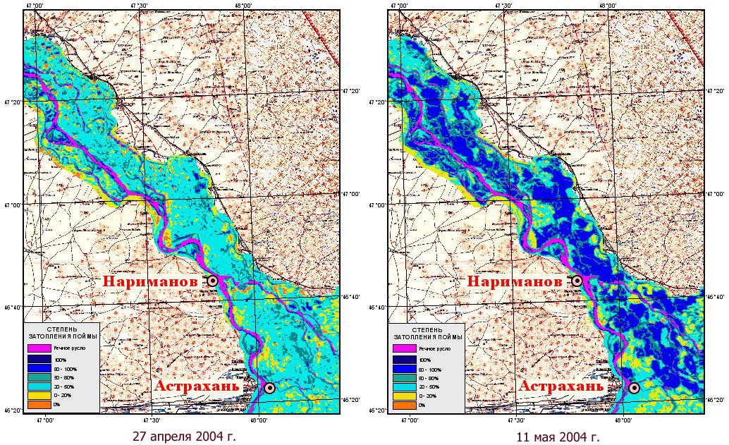
Images: the resolution of 250 m, synthesis of channels 2, 1 and 4. Volgo-Ahtubinskaja water meadow has overregulated mode of spring flooding with annually defined terms and the period depending on volume of dumped waters. Usually dump of water from water basins in pool of Volga begins in last dates of April. Water meadow filling occurs to the middle May. To the beginning of June flooding ïîé́û begins to decline.The spring of 2004 in NTs OMZ had been spent supervision over dynamics of flooding by Volgo-Ahtubinskoj water meadow . Thematic processing is made by means of GIS-SOFTWARE PACKAGES. Results are presented in the form of the classified images of flooding ïîé́û, imposed on a scale topographic map 1:500000. The allocated classes correspond to flooding degrees ïîé́û (in %); besides, lilac colour allocates a river channel ́åæåííîăî the period (September, 2003) . For representation of a course of flooding ïîé́û images are more low resulted: on April, 27th — prior to the beginning of flooding, on May, 11th — on flooding peak.
 |
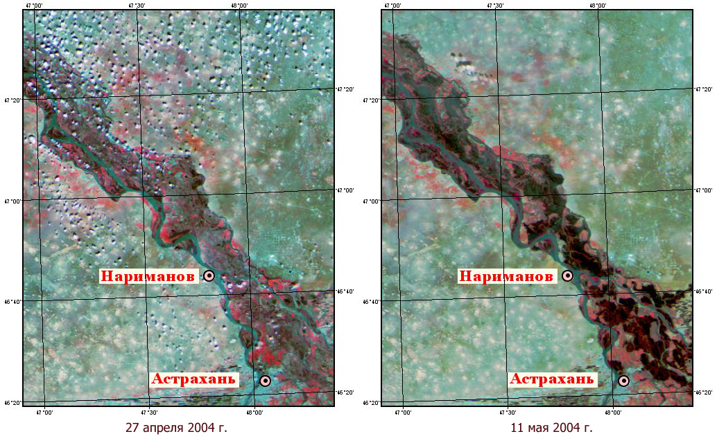 |
Dynamics of flooding ïîé́û around Íàđè́àíîâ during the period from the end of April on the middle of June
 |  |
 |  |
 |  |
 |  |
 |  |
 |  |
 |  |
 |  |
URL äîêó́åị́à: http://www.ntsomz.ru/projects/emergency/navodn_may
Copyright © ÍÖ Î̀Ç